 |
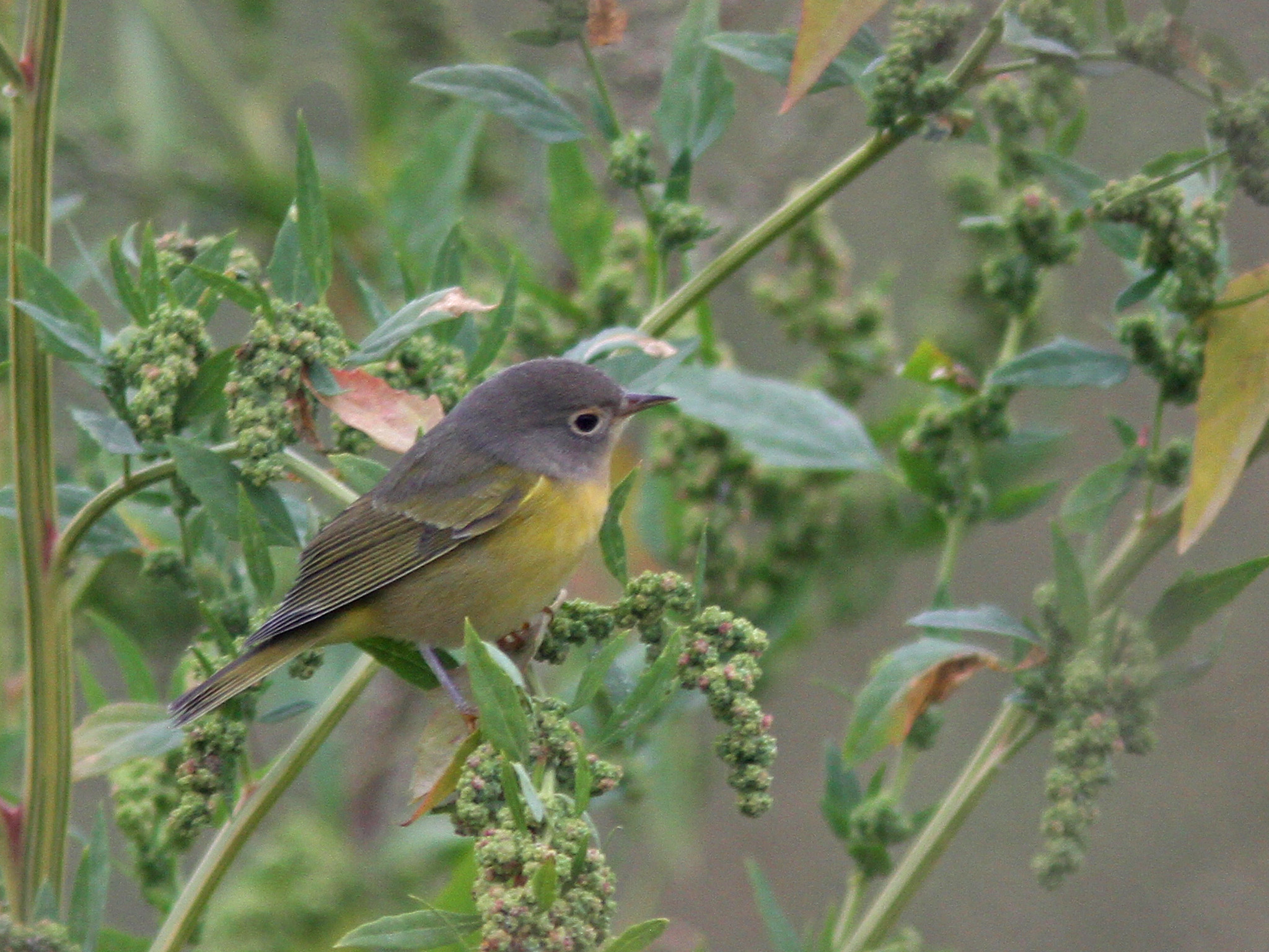
| Common Yellowthroat, Arcadia, Northampton, MA, Sep 30, 2016 |
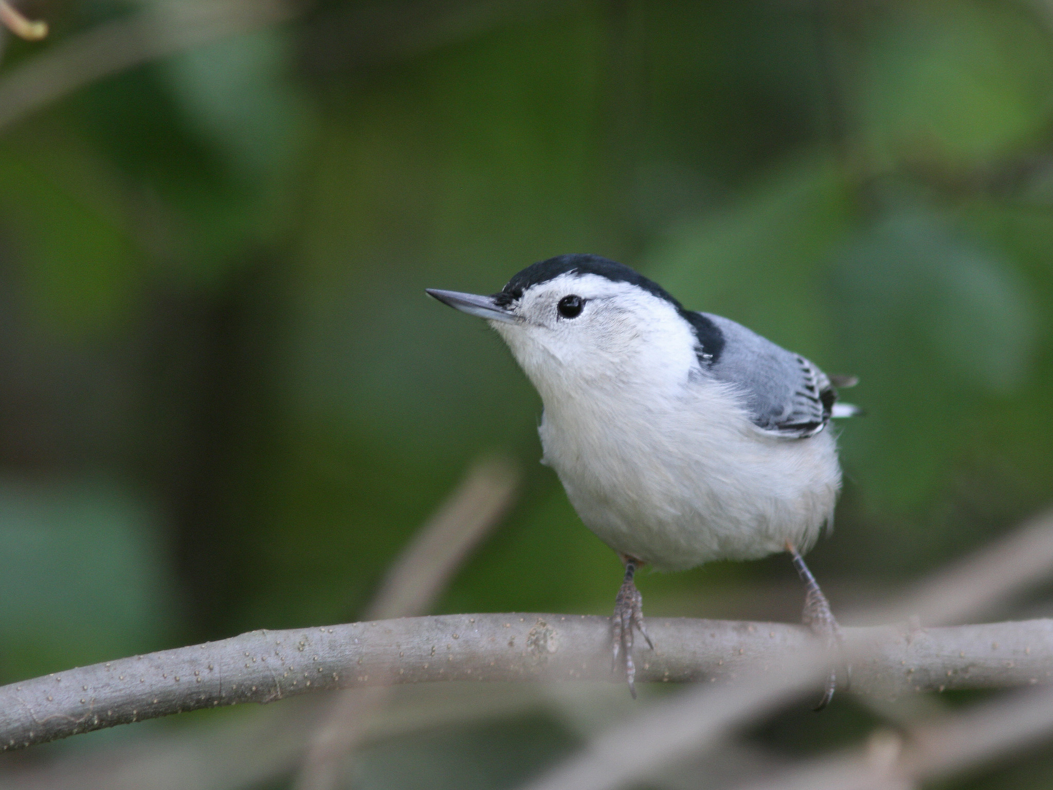 |
| White breasted Nuthatch, Arcadia, Northampton, MA, Sep 30, 2016 |
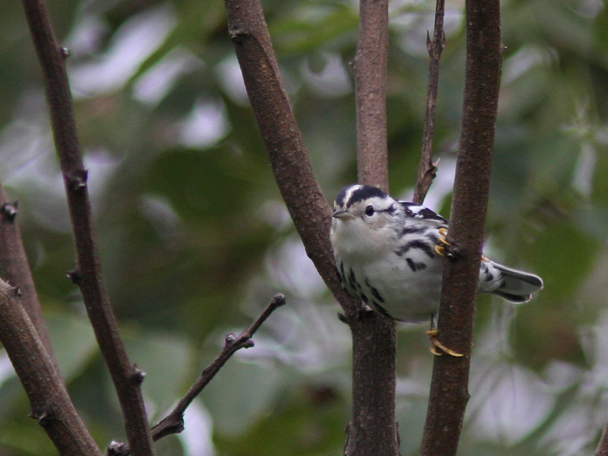 |
| Black and White Warbler, Arcadia, Northampton, MA, Sep 30, 2016 |
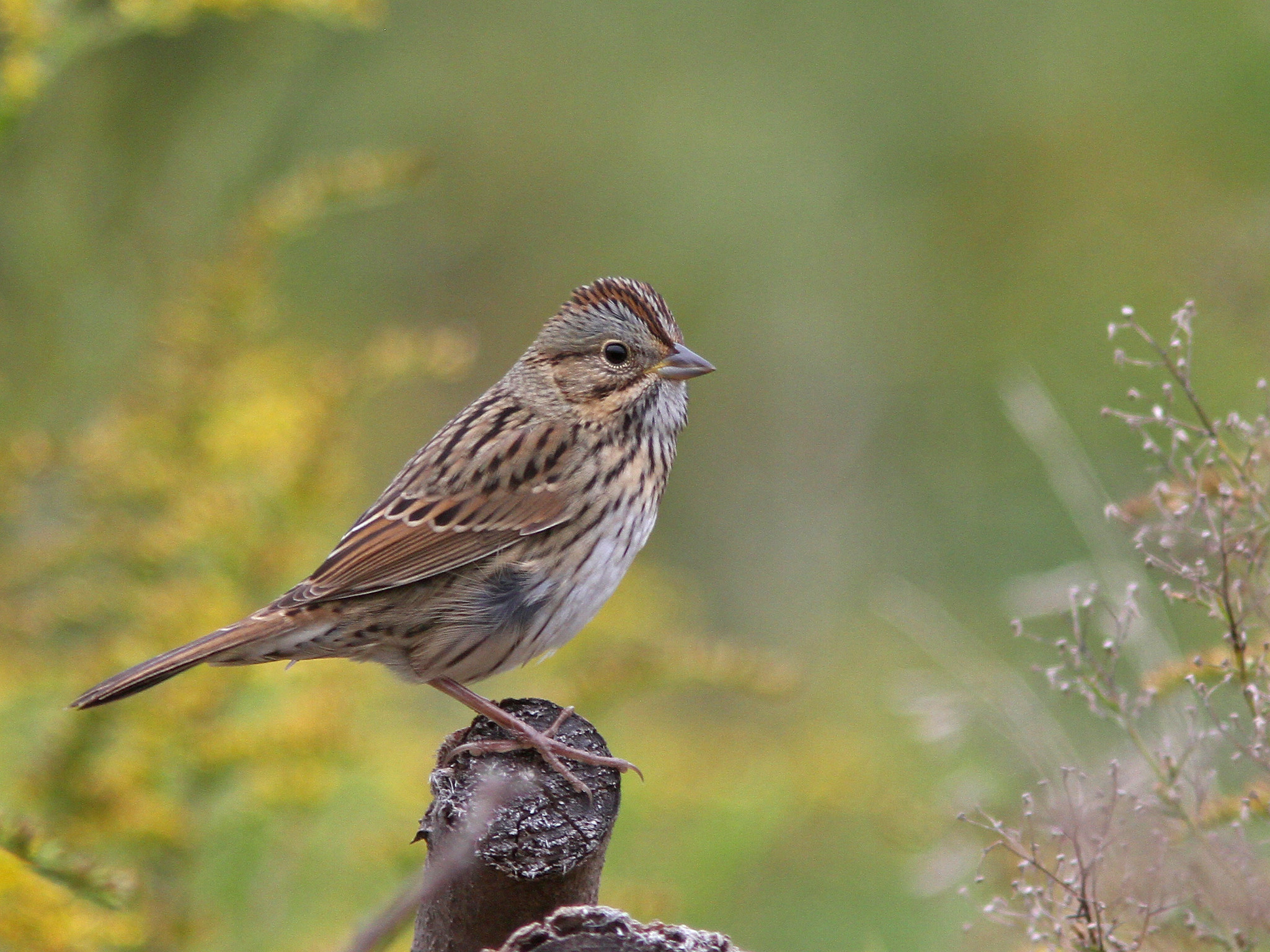 |
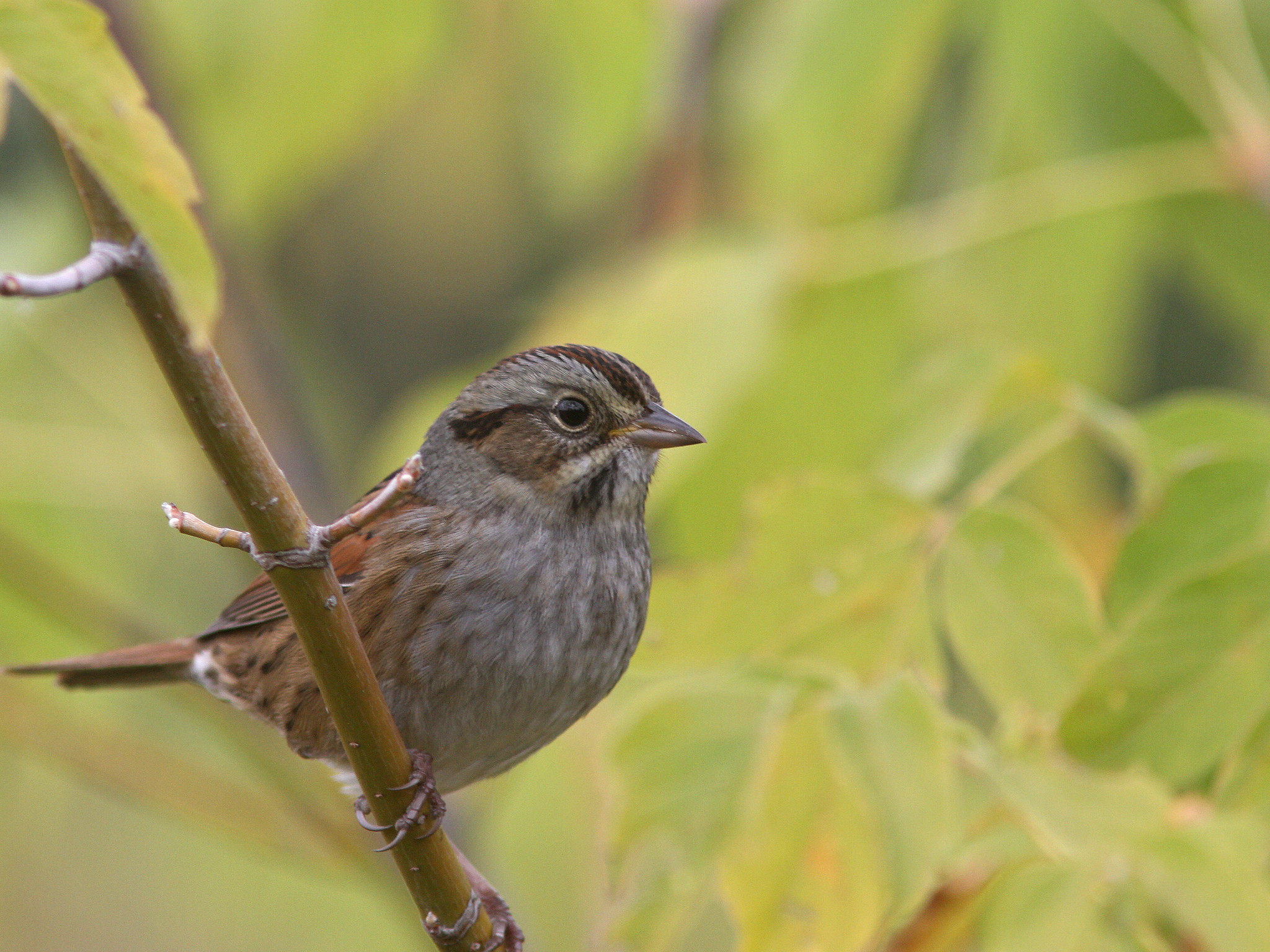
| Lincoln's Sparrow, Arcadia, Northampton, MA, Sep 30, 2016 |
 |
| Yellow rumped Warbler 'myrtle', Honey Pot, Hadley, MA, Sep 30, 2016 |
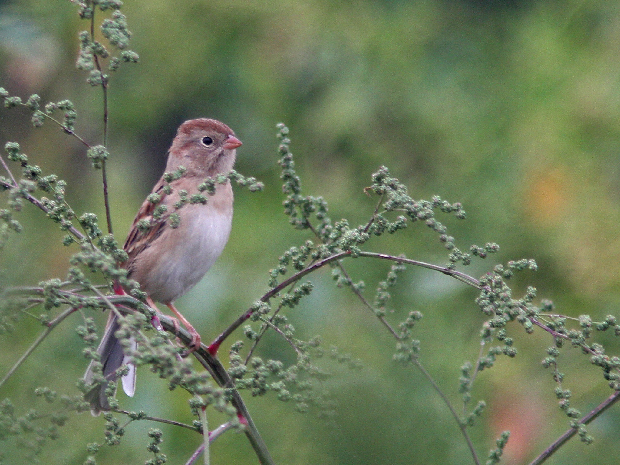 |
| Field Sparrow, Honey Pot, Hadley, MA, Sep 30, 2016 |
 |
| Nashville Warbler, Honey Pot, Hadley, MA, Sep 30, 2016 |
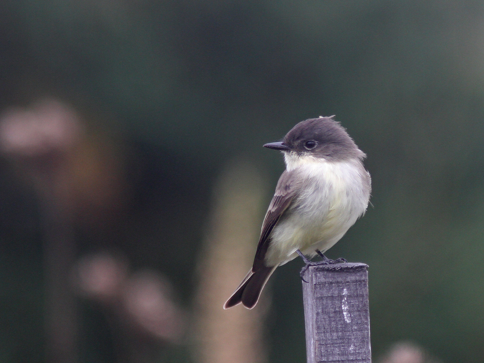 |
| Eastern Phoebe, Honey Pot, Hadley, MA, Sep 30, 2016 |
 |
| Swamp Sparrow, Honey Pot, Hadley, MA, Sep 30, 2016 |
I spent the morning birding a potion of the morning with Keenan and then a bit on my own in some very fall like conditions with overcast conditions, a steady breeze and temperatures starting in the 50's and not warming a whole lot. It was a bit quiet at times due to the conditions but we still found some good stuff during our time at Arcadia including another Connecticut Warbler and an Orange crowned Warbler among eight species of warbler plus at least eight species of sparrows as well as another that may have been a Nelson's Sparrow but I was unable to confirm. Also a decent show of raptors around which certainly kept some birds from showing themselves to us. After Keenan had to leave I spent a bit more time at Arcadia before heading over to the Honey Pot where I found more warblers (including a late Yellow Warbler) and sparrows. Also ran across a large gathering of Eastern Phoebes at 'That's a Plenty Farm' that I hoped to find an unusual flycatcher in but no luck today. Full lists with more photos below:
Arcadia:
http://ebird.org/ebird/view/checklist/S31823303
Honey Pot:
http://ebird.org/ebird/view/checklist/S31823336
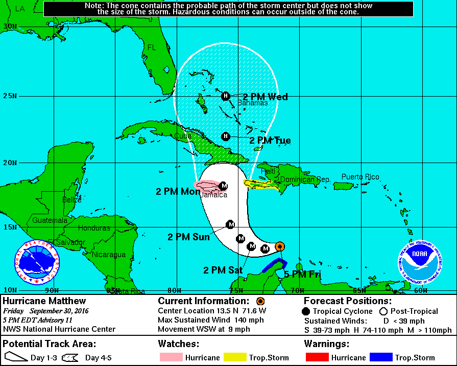 |
| Hurricane Matthew projected path, Sep 30, 2016 (courtesy NHC) |
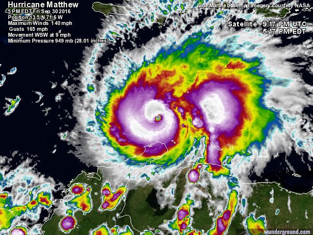 |
| Hurricane Matthew, Sep 30, 2016 (courtesy of NASA) |
Now for the latest on what is now Hurricane Matthew spinning down in the southern Caribbean. It reached hurricane strength yesterday and then rapidly intensified to a Cat 4 storm today with 140 MPH winds with a pressure down to 949mb! It strengthened much more rapidly than predicted despite some fairly strong wind shear (makes me wonder what will happen once the shear drops off a bit). It is starting to look more and more impressive and is almost certain to have a major impact somewhere in the Caribbean. The current forecast has the storm continuing west before making a sharp turn to the north and impacting Jamaica and Cuba as a strong Cat 3 storm. The real question then becomes what happens to the storm after that. It should end up in the Bahamas slightly weakened after interactions with one of the large islands but given the warm SST's there it is likely to regain strength once again and then either threaten somewhere on the east coast of the US or head out to sea. Still a lot of variables that will have an impact on the storm over the long term but suffice it to say the storm has some great potential to impact the US somewhere, possibly even New England.
No comments:
Post a Comment