 |
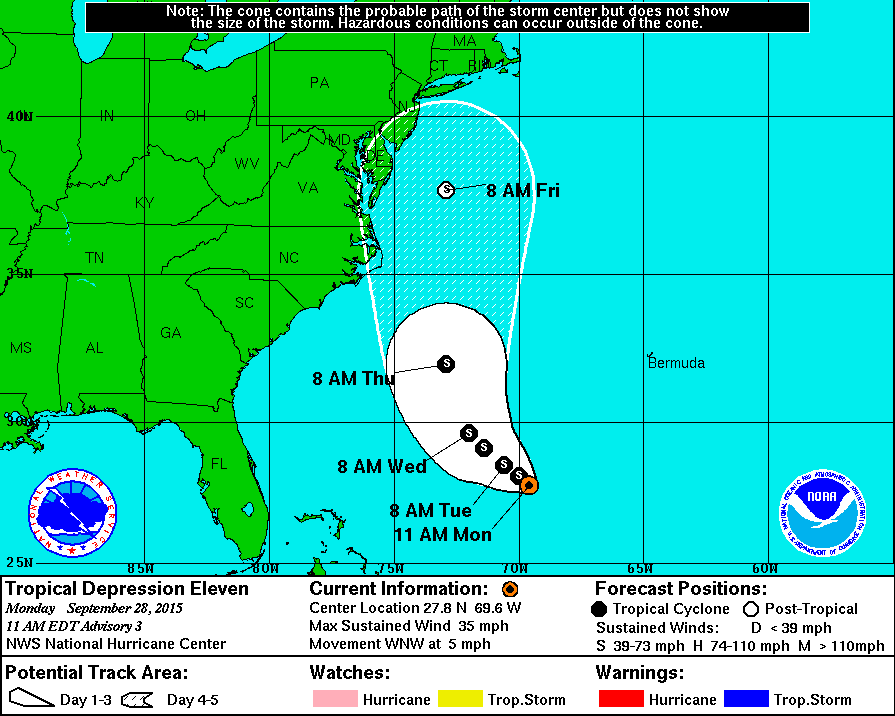
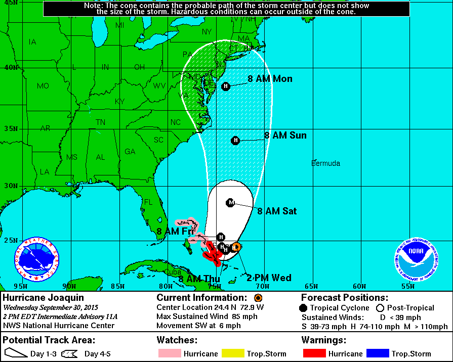
| Hurricane Joaquin forecast track as of 2PM, Sep 30, 2015 (map courtesy of the NHC) |
Link to some additional related information regarding the storm and related birds can be found at a Birdcast post here: http://birdcast.info/forecast/special-alert-upper-midwest-and-northeast-tropical-storm-joaquin/
A link to tropical system related birds in western Massachusetts as well as various of useful links related to tropical weather can be found at this link from an earlier post:
http://quabbinbirdingandbeyond.blogspot.com/2015/02/a-look-at-tropical-storm-related.html
Below is the projected storm location and strength for the next five days.
FORECAST POSITIONS AND MAX WINDS

INIT  30/1500Z 24.7N  72.6W   70 KT  80 MPH
 12H  01/0000Z 24.3N  73.2W   80 KT  90 MPH
 24H  01/1200Z 24.1N  74.0W   85 KT 100 MPH
 36H  02/0000Z 24.4N  74.4W   90 KT 105 MPH
 48H  02/1200Z 25.3N  74.5W   95 KT 110 MPH
 72H  03/1200Z 28.5N  73.5W  100 KT 115 MPH
 96H  04/1200Z 34.0N  73.0W   90 KT 105 MPH
120H  05/1200Z 38.5N  74.0W   75 KT  85 MPH
Last night and today we have dealt with heavy rain associated with a variety of weather features and the rains produced 5"+ of rain leading to some local flooding. Beyond a few species of waterfowl likely being forced down I have not seen nor heard of anything way out of the ordinary associated with the heavy rain of yesterday and today.

